Organ Pipe National Park

Organ Pipe National Park

About Me

I purchased "Sadie''s House On Wheels "in late 2007 and loved traveling in a motor home so much that I went on the road full time in late 2008. I started writing this blog to help me remember all the wonder places I have been and it allows me to share those places with my family and friends. Summer of 2013 I decided to hang up the keys for a while and moved back into my stick house. After nearly two years, I am on the road again.

Monday, August 29, 2011

Hurricane Irene, August 29

We woke up to rain and fog on Sunday morning and scurried down the dirt road out to Highway 1. The hurricane had been down graded to a tropical storm, but you never know.. We had decided that Machias, about 40 miles away and a little more inland would be a good place to wait out the storm and it was near a main road. The trick was to find some place that wouldn't flood, and would be away from  flying debris.  The forecast still indicated that we would not be in the "extreme" path of Hurricane Irene, but we would still feel the effects of it.

We found a nice level paved parking area in Machias and the owner said we could park and wait out the storm, but there could be a possibility of flooding due to the high tide, and he would be checking his property through out the day. Maybe we should search for higher ground??? We checked out some higher ground, but decided we would be fine where we were.

The rain came and the wind blew all night, but it wasn't that bad.... a little rock'n roll'n during the night with a few strong gusts occasionally, but that was about it.


This morning we woke up to sunny, brilliant, but windy skies, thankful that I wasn't in Vermont or somewhere else where roads are badly flooded.

Before leaving Machias, we checked out the Machias River and Little Bad River Falls. 

Machias River, Machias


These are the Little Bad Falls, which is what Machias translates to.

 We thanked the owner of the parking lot we stayed in (he was out and about early checking on his property) and headed down the road to Ellsworth near Acadia National Park.  The drive down to Ellsworth was uneventful, without any signs of damage... just normal driving on a two lane bump road.

Eastport, August 27

Eastport is the furthest north eastern town in the US and is about 1/2 hour from our camping  site.  After checking the weather and the where abouts of Hurricane Irene, we decided it would be safe to go check out Eastport.  In addition to being the furthest eastern town, there is a phenomenon called the Sows Whirlpool where the tide forms a giant whirlpool, the second largest in the world, and can be seen from Eastport.  Oh what tourists we are! The catch is that the whirlpool is best seen 2-3 hours before high tied, in this case between 7:00 and 8:00 A.M.

We arrived at Eastport to find a town still asleep. ... not much activity at all.  We found the spot to view the whirlpool and much to our disappointment couldn't see much.  We hung around for a while and then decided it was time to find breakfast.  Surely there would be something open on a Saturday morning.  We stopped to talk to one of the locals about the whirlpool.  The first thing out of his mouth was "I wish they would stop publishing stuff about the Sows Whirlpool, It is such a disappointment".  We all got a good laugh.  Apparently the whirlpool does exists, but it is best seen from across Eastport by taking the ferry and sometimes it is more visible then others.


 I guess if you can use your imagination you can see the whirlpool towards the rocks in the middle of the picture.
 We wandered around town and watch  a father and son land some mackerels.
 This statue was erected for a TV reality show (don't remember which one) and the city like it so much they refurbished it and it is still standing.
 We found a great little Cafe called WaCo and had breakfast.  Its the little grey building in the picture below.  It is suppose to be the oldest cafe in the area or was it Maine. The last two initials of the proprietors makes up the name. I wished I had remembered to take a picture of our pancake sandwich.  The pancakes covered the whole plate!  It was a good thing we shared it!
 The quaint little fishing  village taken from the pier.
After breakfast we walked around town some more killing time, it was such a beautiful day.  We hung out long enough to have lunch and sample a "lobstah roll".  Not bad.  I think you get a whole lot more lobster on a sandwich with less work than eating a whole cooked lobster.

We continuously kept checking on Hurricane Irene and it looks like we will need to leave tomorrow.  She's coming this way...but it looks like we are far enough east that we may be just on the fringes . The folks in Eastport didn't seem concerned at all about the hurricane saying it wasn't going to be any worse than their Nor Easters which bring snow instead of rain, which confirms what we have been hearing all along.


Campbobello Island, New Brunswick August 26

According to the GPS New Brunswick is only about 8 miles away for our camp site ...as the crow flys.  One can drive to Campobello Island from Lubec  about 20 miles  down and around  the road. or take a ferry from Eastport.  There are so many inlets, peninsulas, coves, that to get from point A to point B usually takes a while.  We are still keeping a close eye on Hurricane Irene and it looked like she is still a day or two a way and today is suppose to be sunny, so without further debate we headed over to the island.  What a gorgeous day it turned out to be!

OK.  Whats on Campbello Island?  It was the summer home of Franklin D Roosevelt and has been turned into the beautiful Roosevelt Campobello International Park. Roosevelt's summer summer cottage is open to the public for free.  The park it self has numerous hiking and carriage trails and a nice place to spend the day ....except for the bugs.  The island survives on a fishing economy but is also a tourist destination without being really crowded.  It reminded me of the quaint little fishing villages found in Sourthern Portugal.


Mulholland Lighthouse on Mulholland Point looking towards Lubec, Maine.


Lubec, Maine from Compobello Island, New Brunswick.

FDR Memorial Bridge.  The US and Canadian Customs were probably the most friendly agents I have encountered on the US/Canadian border.  It was an easy crossing with no traffic or hassles.
FDR's summer "Cottage"  There are twelve bedroom on the second floor.  FDR parents vacationed on the island with he was a baby and they liked the area so well they bought property for a summer cottage.  Later FDR's mother Sara bought the cottage for FDR as a wedding gift. The cottage was later sold but FDR's son Elliot purchased the cottage and donated it to the park when the park was being established.  Most of the furnishings inside are original.  The cottage  is immaculately kept and the docents are very knowledgeable.  The park is funded equally by the US and Canada.

Its seems the Canadians love their summer flowers because every time we have been to Canada we see beautiful annuals.
 The back of the cottage has an expansive grassy area which over looks the bay towards Lubec.
 How would you like to cook on this wood burning stove?  There was no electricity in the cottage.
 The Cottage over looks this cove.  Today  Atlantic Salmon farming is done in the pens in the picture.


Another landmark on the island is the Head Harbor Lighthouse.  It is featured in many magazines and brochures.  You can walk to the Lighthouse at low tide for $5.00 and for another $10.00 you can go inside the lighthouse.  $15.00 seemed pretty steep for the privilege to walk to the lighthouse and up all those stairs so we enjoyed it from a far.

 There are lots of coves and sandy beaches on the island.  I'm used to the white sandy beaches of the central coast of California, so these black sandy beaches weren't really that appealing to me.


This is an example of the extreme tides in the area.  The high tide goes all the way up to the trees.  If you look really carefully you can see a boat in the middle of the picture that is stranded.
 Another one of the pretty scenes on the island.


Can you say low tide??
a
Herring Cove is inland, and a very calm cove where fisherman dock their boats.

The crab pots and lobster ("lobstah "in Maine language) are ready to go out.
 As we were driving a long we came across home which had a yard full of lobster and crab gear. The owner told us this was just some of the gear her husband used for his business.  That's a lot of gear.
 and these were just some of the buoys used.  Aren't they colorful?


This was a really nice day trip.  I was really impressed with the low key and slow pace of the island.  Time permitting it would have been fun to hike some of the trails, but with the hurricane lurking, it's best we not doddle as there are other places to go and see.

Sunday, August 28, 2011

Reversing Falls, August 25-28

Reversing Falls Park/Reserve (I'm not sure what it is called) is a nice grassy area on top of a small knoll which overlooks part of Long Cove on the Cobscook Bay. Canada is only a few miles across the Bay and our cell phones are really confessed because they keep bouncing back and forth between Atlantic and Eastern time.  We are close to Pembroke and Lubec, so we  pretty far north on the coast, which is beautiful.

Reversing Falls is a phenomenon which occurs as the tide come and goes.  Because of the coves and islands a reversing tide effect occurs making it look like the water is flowing backwards.  It's hard to see in the pictures but it is quite dramatic near low tide.  The tidal changes are very dramatic here.  There can be as much as a 50 foot tide at certain times and it is quite evident.

Our plans were to stay a few days and explore the area contingent on Hurricane Irene which was scheduled hit the New England area on Sunday.  The biggest concern is getting stranded due to either flooding tides and rivers or downed trees on the roads.  We had to drive several miles on a well graded dirt road with lots of trees right on the shore of the cove to get to our quiet campsite. The paved roads out are narrow and near tidal zones with lots of trees.


 Looking towards Long Cove.
What look like rapids (below) is really the reversing falls effect.  The water flow churns up aquatic life for the birds and seals.

 A tranquil misty scene at high tide.
Below a seal plays in the water and enjoys the plentiful food churned up by the tides.  There were
several golden eagles in the area as well as lot of other birds.
While in the area we hope to visit Campobello in New Brunswick and Eastport, Maine, the most north eastern town in the US, so check back for more.

Thursday, August 25, 2011

Millinocket, August 21-25


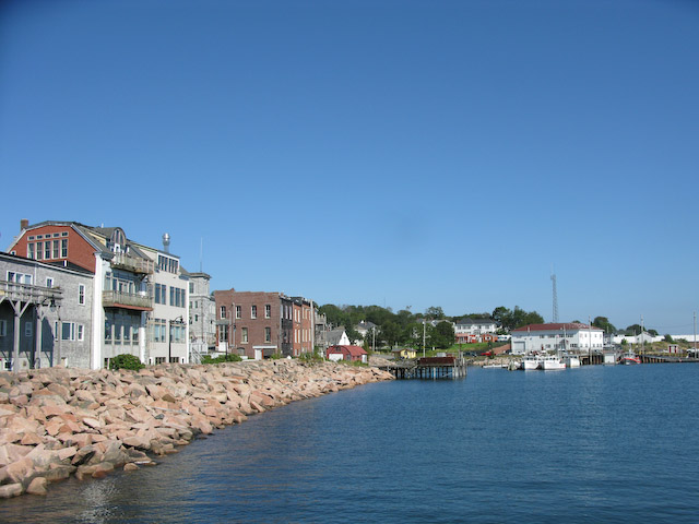
We moved on down the road to Millenocket...well not exactly moving "on down"....but moving on down and around.  There is no easy way to get to Millinocket from Greenville.  As the crow flies its only about 60 miles of North Main Woods private dirt roads and gates.  It takes about 120 miles the RV friendly way and still the road was bumpy in places. 

So whats in Millinocket?  Nothing.  But....it is the closest town near Baxter State Park where Baxter Peak is located on Katahdin.  Baxter Peak is also the northern terminus of the Appalachian Trail. Baxter State Park does not allow any motor vehicle more than 22 feet long, 9ft wide and 7 feet high. BSP is mostly a hiking destination.  Not exactly RV friendly.  There are lots of places to pull off the Golden Road which is a private logging road or off the Baxter State Park road, but we elected to stay in town at the American Legion...a very friendly post according to Joel.

The main reason for coming to Baxter State Park was to hike to the top of Baxter Peak the high point of Maine, almost a mile high.  Also, my medicare card would be occupying my wallet in a few days so what better way to celebrate! We had been watching the weather and it looked that there was a two day window of good weather so Tuesday, Joel dropped Nancy and I off at the trail head for an early start, I mean really early..6:00. We took our first steps on the Appalachian Trail about 6:30.  The hike is about 10.5 miles round trip with an elevation gain of over 4000 ft., so its  not your average hike and rated as "difficult".    We'd been told to allow at least 10 hours so we figured it would take at least 12 hours for us seniors.

The first few miles of the trail were very easy with a very gradual climb.  I'm thinking to myself "this is not all that difficult...so far".   The brook that flowed along the trail was pleasant.


The Katahdin Falls are not far from the trail head, and it would be the last falls we saw on the trail.

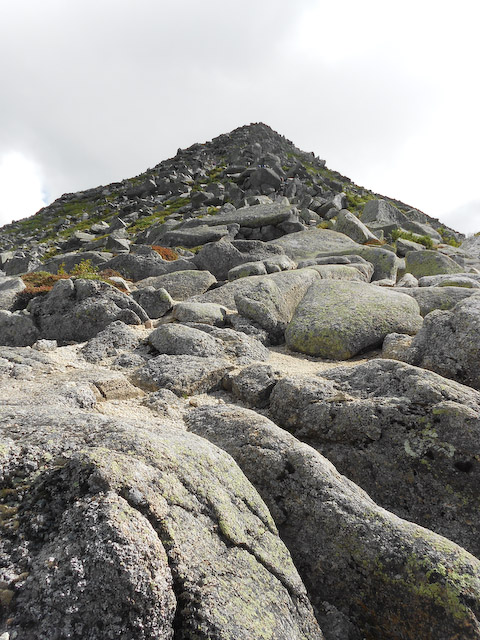
We took the Hunt trail which is also the official Appalachian trail.  The trail is marked with white blazes like the small rectangle square on the tree below and ins some places the trail is marked with the blazes on rocks or boulders.  Yep, that's a trail in the picture below.


The trail continued until we started above the tree line, and then we came across "the boulders" and the "monkey bars" below. Can you see the metal bar and little hook below it?  That is what we used to get up over the rock.


So we have to get to the top, and that's not the peak. It seemed to take forever. 


Can you see the white blazes on the boulders marking the "trail"?

Nancy makes it look easy:


Nancy took a few action shots of me negotiating some of the boulders.  My little short legs sure got a workout!


Whew!  I made that one!


Pretty steep!


But that's not the end.


Are you kidding me!!

I was also battling the wind.

OK. I made that one!


Wow, it feels good to be on some ground!!


But there is much more to go!

We got to the top and then had to cross the "table" to the peak which was a gentle climb, but rocky.  The peak is towards the left where the clouds are.


Yea!! We made it to the top.  The wind was ferocious and it was very cold so we didn't spend much time at the top savoring our accomplishment.


This is the official peak.

The rocks are supposedly piled high enough that the top rock is exactly one mile high.

The views were spectacular.


So, what goes up must come down.  We started down on the Saddle Trail which was suppose to be easier. The trail looks easy, but we were walking on tennis ball size rocks...all loose. At this point the trail is marked with blue blazes...on rocks... and there are also large cairns piled along side of the "trail".  You see one of the giant sized cairns below near Nancy.


Then we came to the junction of the Saddle Trail and the Chimney Pounds Trail. Nancy is just starting to head down in the above picture.  The picture below is what I saw as I started down. You call this a trail? I call this a land slide. There were loose boulder size rocks with blue blazes indicating a route down down the land slide.  I think it took us almost two hours to get down out of the loose rock but then the next 4 miles were spent rock hopping through a dry stream bed. I'd call this mountain climbing, not hiking!

Our destination is at the bottom where the ponds are.


This type of "trail" went on for miles.

and miles, and miles.....


It took us a little over 6 hours to get to the top of Baxter Peak about 5 miles.  We figured it would take less time to go down the mountain  but it took almost 7 hours to get back down to the Roaring Brook parking lot about 5.5 miles. The "easier" way over the mountain took us a lot longer, but both Nancy and I  agreed we didn't want to go back over the Hunt trail and have to go down all those big boulders.


So, another "epic" hike under my belt.  Thanks to Nancy, for taking pictures of my adventure and sharing them with me.  Now, both Nancy and I can say we have climbed the highest peak on both the West and East  (we don't count Denali in Alaska).

Needless to say, the next day was a day of rest which included a few pain killers.  On Thursday ,we headed over to the coast of Maine, at least for a few days, but hurricane Irene may dictate how long or where we will stay. We have found a great little dry camping spot near West Pembroke to watch the Reversing Falls.  There is no cell coverage but Joel's internet is functioning.

More on the Reversing Falls and the area later.