Organ Pipe National Park

Organ Pipe National Park

About Me

I purchased "Sadie''s House On Wheels "in late 2007 and loved traveling in a motor home so much that I went on the road full time in late 2008. I started writing this blog to help me remember all the wonder places I have been and it allows me to share those places with my family and friends. Summer of 2013 I decided to hang up the keys for a while and moved back into my stick house. After nearly two years, I am on the road again.

Sunday, August 29, 2010

August 26-28, On to Prince Rupert

We back tracked back up the Stewart-Hyder Highway (37A) and back to the Cassier Highway (37).  Along the way we stopped at several First Nation Villages to see totem poles.   The fist village was  Gitanyow, where there were many reproductions of totem poles. The plaque below explains what the poles stand for. 


 The Mile Post had indicated the totems at Gitanyow were the oldest, but I think the oldest were at Gitawangak.  They were leaning and looked very old and authentic.  One of the local stopped to warn us as she was driving by, not to get to close because there were precariously leaning towards the street.


We also stopped at Kitwanga and viewed the Kitwanga Fort National Historical Site, the first major Canadian Native site to be commemorated by Parks Canada.  
We continued to the junction of the Cassier and Yellowhead (16) and headed towards Prince Rupert.  We stopped in Terrace for the night at the Ferry Island Municipal Campground.  Its a wonderful campground with a nice walking loop along the Skeena River in the rain forest.  There are about 53 whimsical tree carvings along the loop. It was kind of like a treasure hunt looking for and finding the carvings. 


                             Liz and Nancy have found one of the many carvings.


                                            The campground sits beside the Skeena River


There were other things to see and do in Terrace, including lots of hiking and there is suppose to be good mountain biking.  Next time.  
Friday, we continued to Prince Rupert and headed directly to the information center.  I thought the GPS was acting up again because there was no visitor center at the address I had entered.  We found the visitor center, but at a different spot after much circling. Apparently the center had moved and we had the wrong address. My apologies to the GPS.  Prince Rupert is not RV friendly, at least in the Cow Bay and Down Town area.  The streets are narrow and the parking lots small, and unlike most visitor center there is no parking.  I finally found a place to park on the street, taking up 4 or 5 spaces.  
We determined that there would be no boon docking and back tracked to Prudhomme Lake Provincial Park.  A very nice campground, right off the highway.  With it being Friday, I was concerned about finding a campsite.  The three of us didn’t have any problems finding a site, but I was glad we weren’t much later because the campground filled up pretty fast.  
Saturday morning we headed out to Butze Rapids.  This is a reversing tide rapid.  One is suppose to see the rapids reverse with the change in tide.  As suggest by the Mile Post we arrived at the site about an hour after low tide and watched as the tide came in.  The changes were very subtle. ...like watching grass grow.  Pretty though.  


                      Butze Rapids during the tide change.  The tide is coming in.


                                   Grassy Bay with the rapids about the middle of the picture.


Next we went to the North Pacific Historic Fishing Village and Museum in Port Edward, just a few miles from Prince Rupert.  The Pacific Cannery was built in 1889 and housed a salmon cannery.  It was interesting to learn how the canning process evolved from everything being done by hand to being almost totally mechanized.  The cannery continued running until about 1972.  Most of the canneries have burned down or have been abandoned and the Canadian Government purchased the Pacific Cannery and has restored much of it.


The cannery also house the workers and you can see some of the house at the end. 


Some of the nets.  The owner paid $183 for the property to build the cannery, but that was a bargain.  He had to pay $150 per net.  

                          These are the tools used to make and repair the nets.


The workers were paid at the end of the season.  They bought everything at the store on credit, and at the end of the season, the balance was applied to their earnings.  Usually, there wasn't much left over.  
All of the fish offal, heads, tails, fins, etc were boiled down to fish oil, which was stored in these big tanks.  

We visited the Cow Bay district of Prince Rupert.  It is full of little speciality shops and the streets are decorated in black and white to depict cows..even the dumpsters are painted.  The story is that cows were being brought to Prince Rupert and there was no dock to off load them so the cows had to swim to shore.  


The town also has a nice sunken garden, which is being restored.  


There are totem poles sprinkled throughout the town.  We visited Totem Park and saw two reproductions , but they were not as impressive as the ones we had seen in Gitawangak.  


Tomorrow we back track along the Yellowhead towards Smithers.  Liz’s tow bar is being shipped there and hopefully her car will be waiting for her there also.    

Thursday, August 26, 2010

August 23-26, Stewart BC and Hyder AK

We lift the Tanzille Campground under, can you guess...rainy skies.  It rained continuously to Stewart along the Cassier Highway, all 240 miles. As a result we only stopped for breaks and lunch.  
Once we turned off the Cassier Highway and on to the Stewart-Hyder Highway the rain seemed to get worse.  The drive down the canyon was pretty and peppered with lots of road side glaciers but the mountain tops were shrouded in heavy clouds. 
Liz needed to make some phone calls once we got to Stewart to follow up with the folks that were driving her car.  She found out they were still in Stewart and would be for a day or so.  Stewart does not allow overnight camping anywhere other than in one of the RV parks. So we decided we may as well stay where Liz’s car driver  people were staying and headed over to the Bear River RV park.  Liz also had to call Blue Ox to make the final arrangements in getting her tow bar fixed.  It turned out the folks that were driving Liz’s car decided they did not want to drive it all the way to Prince George.  To make a long story short, there was another couple in the park who volunteered to drive Liz’s car to Smithers, which is a big city on our route.  Liz made arrangements to have her tow bar shipped to Smithers at the RV park where the driver will leave Liz’s car.   So, hopefully this saga will have a happy ending.  I’ll fill you in later.  It just goes to show you how nice RVers are and how helpful they are.  This whole episode could not have happened in a more remote area.  We have had no cell coverage since we left Haines and little internet coverage.  
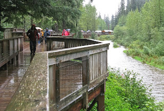
We settled in at the RV park and headed off to Hyder, Alaska the next morning which is only about 3 miles from Stewart, to see the bears at Fish Creek.  Fish Creek is famous for its elevated, slatted boardwalk viewing area of the grizzle bears.  The bears feed on the salmon swimming to their spawning grounds between late July and Mid-September.  When we got there, the place was teeming with photographers all lamenting on the fact that the bears had not been seen for several days.  We did see a black bear sow and her cub on the road on the way, but no grizzlies.  

Elevated walkway/viewing area at Spring Creek


Pool adjacent to the walkway
We decided to drive the Salmon River self guided auto tour up to the summit to view the Salmon Glacier.  Its a bumpy dirt road for about 25 miles, but the vistas were beautiful! The sun decided to poke through a little  and it quit raining for a while.  


Salmon Glacier
Salmon Glacier is huge.  It has two branches and seems to go on forever.
                     

Part of the Salmon Glacier

Liz and Nancy decided they should take me out for dinner for my birthday so we stopped at “The Bus” for dinner.  It’s an old school bus that has been converted intso a kitchen where delicious fish dinners and hamburgers are cooked.  The cook, Diane is a one lady show.  She cook, serves, and also runs the fresh fish market.  The food was very good. It takes a while for the food to cook, as Diane only cooks a few orders at a time, but the wait is well worth it.  Its kind of a funky place as is the town of Hyder.  

The Bus

Funky house in Hyder

Wednesday morning we went out to see the bears again and they still weren’t being sociable so we decided to drive back up the Stewart-Hyder Highway and revisit some of the scenery we missed due to the uncooperative weather in our way into Stewart.  There are few pull outs along the road suitable for RVs, so going back in the Jeep made it easy to pull off and take some pictures.  The sun poked through a little and we were able to see glaciers and water falls.  The roads goes through a big canyon with steep mountains on both sides with numerous waterfalls a glaciers with every turn.  Its pretty impressive.  

Bear Glacier 


Some of the gorgeous scenery along the Stewart-Hyder Highway


This was a really hard picture to take. The sun was in the wrong place.   If you look closely, there is a glacier on top with all of the water falls spilling down. 

After dinner we went  back to Spring Creek to see if the grizzlies were out.  There were plenty of salmon going up stream to spawn but no bears to catch them.  
Tomorrow we’ll head out and continue down the Cassier and then catch the Yellowhead Highway to Prince Rupert.  

August 21-23, Dease Lake and side trip to Telegraph Creek


We continued down the Cassier Highway until we got to Dease Lake.  The weather was predictable...rainy and cloudy and couldn’t see much. The town (not really a town, but more of a place on the road)  Dease Lake is a Talhton First Nations settlement.  Dease Lake itself is up the road a ways and is very big beautiful lake.  We found the visitor center, which wasn’t more than a gift shop, and got a little more information about campgrounds.  We settled on going south a few more miles to the Lions Tanzilla Campground which turned out to be a pleasant campground for dry camping , off the road and on the Tanzilla River.  Its run by the Lions club and is very will maintained.  
Sunday morning we left the RVs at the campground and headed to Telegraph Creek on a dirt road which follows the Stikine River and Stikine River Canyon.  It is a gorgeous drive.  We left under rainy, overcast skies, but the clouds eventually cleared and it turned out to be a nice day.  The tiny community of  Telegraph Creek is at the end of the road. .. literally.  
The end of the road


Riversong Lodge
Look at those blue skies!!


The next stop beyond Telegraph Creek  would be Wrangell and you can only get there by boat on the Stikine River.  Its an old mining town with a few shops, mostly catering to tourists and offer river guides and flight seeing tours to Wrangell.  We stopped at the Riversong Lodge and Cafe for lunch. We also drove out to Glanora an old settlement but there wasn’t much to see.  


Confluence of the Stikine and Telegraph creek
You can see Telegraph Creek Road going up the mountain in the upper center of the picture.

  We had to hike over lava beds to get to the overlook of the confluence.  Sadie is looking out as if to say " hurry up".


Looking towards Wrangell.  


We returned to camp to find the campground empty, except for our three RVs.  Tomorrow we head for Stewart and Hyder.  Stewart is in BC and Hyder is just a few miles down the road but in Alaska.  

Saturday, August 21, 2010

On to Cassier Highway, August 16-20


Back tracking on the Haines Highway


We back tracked on the Haines Highway to Haines Junction enjoying clear skies and wonderful vistas.  Some of the mountains were very hazy, most likely from forest fires. The border crossing was uneventful, although we did wait awhile.  The agents seemed more concerned about weather or not I had any fresh or frozen salmon or had I been fishing.   
We stopped again at Haines Junction for treats at the bakery and then made our way to Whitehorse to stalk up on groceries.  Whitehorse will be the last big city for a while.  
We spent the night in Whitehorse and then continued on to Teslin to the Tlinglit Cultural Heritage Center,  which opened in 2001.  It was a pretty big deal for the First Nation Tlingits to open the center.  We spent a few hours there, mostly watching a long video, and then headed towards Watson Lake, which is just past the junction of the Cassier Highway.  
Tlinglet Heritage Center

Canoe on the Teslin Lake
We hit smoke near Rancheria from forest fires  about 50 miles east of Watson Lake and continued on until it became pretty thick.  We debated whether to turn around or keep going.  Some folks stopped coming from the junction said there was no smoke there so we continued on until we got to Big Creek Campground, a nice Yukon Government Campground.  Some of the campsites were overlooking the river.  It was a little smokey, but not bad.  
We had noticed that the fireweed was losing its blossoms, a sure sign that summer is on the way out.  I also notice that the fireweed stalks stay red for a while after losing all of the blossoms and then the stalks seem to open up a become feathery white.  


We left Big Creek to make it to Junction 37, (as the junction of the Alaska Highway and the Cassier is called) early enough to determine if the road was open.  It had been closed intermittently due to forest fires and traffic was controlled with pilot cars.  We arrived and we told the pilot car would be leaving at 10:00.  There was a huge line of cars.  Liz went into Watson Lake and was to be back by 10:00.  The Pilot Car came a few minutes early and all the cars were through a few minutes after ten, and Liz had not made it back,  and then gate was closed. We were told that another pilot car would be return early afternoon.  So we waited.  When the pilot car came back they said the fire was worse and they would not be making another run.  We decided to go to Watson Lake to spend the night at one of the campgrounds.  
We returned to Junction 37 the next morning and waited until about 10:30 and were told the road was completely closed as the fire had been burning on both sides.  So, we returned to the Watson Lake Campground for another night.  


The line of cars went forever

Oh, Oh..new fire

This morning, August 20, we returned to Junction 37 and were told they were working to clear the downed trees and any other debris the could potentially fall on the highway and they were hoping to open it.  Finally, about 1:30 we were all allowed through.  Liz ended up being many RVs behind us.  Nancy and I were finally able to find a spot to pull off and wait for her.. and we waited and waited.  She finally showed up..her hitch had broken on her tow car and someone was driving her car for her and she was driving the motor home.  We all dove to Jade City.  


Once we got through it was pretty smokey for about 10 miles and the ground and trees were really scorched.

The drive down the Cassier so far has been really pretty.  There are lots of small lakes and stream, and few places to pull over.  Had the road been better I would have taken windshield pictures but I didn’t take too many because the road is is very narrow.  

Saturday morning Liz was able to make phone calls to Blue Ox about her tow bar and arranged for her car to be driven to Prince George.  She'll need to call Blue Ox again by Tuesday to talk to the Canadian Representative and figure out where a new tow bar can be sent and installed.  

Jade City folks have been wonderful.  They have free overnight camping, wifi, free coffee and lots of Jade jewelry to buy.  Very friendly and helpful folks.


We'll continue on to Dease Lake today along the Cassier Highway.  


Friday, August 20, 2010

Haines, August 11-15


Haines
Of all of the coastal towns we have visited, Haines has the most “home town” atmosphere.  It’s a place where you go to the grocery store and you run into at least two or three people you know.  The towns folk are very independent yet friendly.  They only have one cruise ship come in once a week , on Wednesday, and they do cater to the “boat people” to a certain extent.  The popular bakery closes on Wednesdays, which is their way of showing their independence.   They are also closed on Sunday.  There are numerous other shops and galleries that also close on Sunday.  Fishing is their main economy with tourism a close second.  The VC closes at noon on the weekends. A popular Haines author has written a book titled If I lived Here, I’d know Your Name.  This about sums up Haines.  
We had wonderful weather while in Haines, the best weather of the whole trip with six consecutive days of sunshine and no rain.  Saturday was almost too hot.    
There are two public camp grounds and parks near Haines: the Chilkat State Park, and the Chilkoot Lake State Recreation Site.  It gets a little confusing and you have to listen carefully because there is Chilkat river mountains, and inlet and Chilkoot river,  mountain, and inlet.  Haines was originally named Chilkoot, or was it Chilkat,  but the town was renamed after Mrs. Haines, one of the first missionaries in the area.  
On Wednesday we drove out to the two parks each is about 10 miles out of town, but in opposite directions.  Chilkat State Park has great vistas of the Rainbow Glacier and Davidson Glacier and calm waters of the bay.  The campsite were really small and not level at all so it was a good thing we didn’t plan on staying there.  The campground was pretty empty.  

Rainbow Glacier


Looking back at the Chilkat Mountains


Chilkoot Lake SRS is the more popular campground and it was pretty full. The main attraction was Speedy and her two cubs.  Speedy is a six year old grizzly.  She has been living at the campground for several years and has a monitoring collar which was suppose fall off in June but it hasn’t yet.  The ranger told us they don’t want to tranquilize her because of the cubs and will wait a couple of more months to take the collar off.  
Mom has caught a fish
She's looking for more salmon


She is sharing it with the cubs


It was quite a site watching her catch the fish and watching the cubs play in the water.  
Haines, like all tourist towns in Alaska that we have visited, prints a walking tour  brochure .  Usually we look at the brochures and pick what we want to explore.  On Thursday we decided to complete  the whole walking tour of Haines and Ft. Seward.  


                                    Ft. Seward
                          This is a stone carving by Judd.  He does lots of stone carvings and has peppered them around town.  


The walking tour leads past a unique museum, something I usually pass up as a “tourist trap”.  I got trapped and actually PAID (it was only $3.00) to go in the Hammer Museum.   Thousands of hammers were neatly labeled and displayed.  In addition to the ones on display there were 6,000 more to be categorized and displayed someday.  It may have been a tourist trap but it was a fun one and the $3.00 wasn’t that bad a price.


    These were my favorite.  Since I'm only 5'2", long handles would be great for projects around the house (when I had one.)


We also did the walking tour of Dalton City which is where the movie White Fang was filmed.  


Its been modernized a little.


The town has several gift shoppes and a brewery. 


Fort Seward


The weather continued to be perfect.  Although, the weather man predicted 20% chance of rain, we ignored the reports and headed back to Chilkat State Park on Friday to hike part of the trail out to Seduction Point.  The trail meanders through the rain forest and pops out a several beautiful coves.  The water was a beautiful turquoise blue and it was smooth a glass.  It was almost like being in the tropics. The trail is seven miles one way and you have to start out at low tide and get back before high tide.  We hike about four miles out to David’s Cove and ate our lunch and basked in the sun.  Liz didn’t go with us, she had booked a wildlife/birding tour.  


Davidson Glacier


We bid farewell to Bill on Saturday morning.  He is heading back to Minnesota via the Cassier Highway (BC 37 )  There have been major forest fires in that area and a hundred mile section from the Yukon border to Dease Lake has been closed for nearly a week.  They are letting cars through during limited hours but you have to follow a pilot car. We hope Bill gets through.  The only other route is to back track to the Alaska Highway.  Nancy, Liz, and I will probably head that direction on Monday, but it will take us several days to get to the area that is closed.  
Sunday arrived way too fast.  Liz headed out on the Ferry to Juneau for a day trip.  The weather was warm and sunny...again!  Nancy and I hiked up to the summit of Riley Mountain,  2.8 mile one way with 1700 ft elevation gain ..The trail was typical of what we have seen...rain forest dispersed with meadows and lots of tree roots to maneuver around.  Our efforts were rewarded with views of the Chilkat and Chilkoot Inlets, the Lynn Canal as well as views of the town of Haines and the many glaciers that look down on the inlets.  The photos don’t really show the beauty.  The mountains were pretty hazy, perhaps from the fires near the Cassier Highway in BC.


Bill, Nancy, and Sadie along the trail to Seduction Point


The inlets near Haines
The village of Haines


Haines celebrated its 100 years of incorporation on Sunday with an old fashioned street fest.  All the town residence gathered together on main street for a group photo followed by a Bar B Que with street music.  Nancy and I wandered down around 3:00 and most of the folks had left.  Guess they showed up for the picture and the free hamburger and decided not to stick around for the music. 


One of the fish wheels along the Chilkat
We’ll leave in the morning for  Whitehorse and start working our way towards the Cassier-Stewart Highway.