A few weeks ago, my neighbor approached me and wanted to know if I did any Jeep'n in my Jeep. I explained I didn't really do anything radical as my Jeep was not set up as a rock crawler and that I loved to explore the back roads. My neighbor wanted to drive the El Camino del Diablo, which is a dirt road that leaves out of Ajo and terminates 118 miles at Wellton (near Yuma), and he and his wife didn't want to do it alone. I decided it would be doable in one day so Joel and I agreed to join our neighbors and then it turned out a third couple would also be going.
The 118 mile dirt road crosses Organ Pipe NM, Cabeza Prieta NWR and part of the Goldwater Range. The Cabeza Prieta NWR and Goldwater Range require permits in order to enter the NWR and Range, so on one of our grocery runs to Ajo, we applied for the permits, sat through the mandatory video in order to be issued the permits and maps, and obtained all the necessary paperwork . The permits are good until the end of June and it turns out there are other places to explore that require the same permits. You are suppose to call the range the day you enter so they know you are there. In some cases you need to obtain a gate combination. We were able to call the day before, mainly because there is no cell coverage in some of the areas.
The day started out early. We left the campground at 7:00 A.M. so we could top off the fuel for the Jeep in Why and be at the intersection of Rt 85 and Darby Road south of Ajo by 8:00 A.M. to meet the other couple.
Joel and I had already driven part of the road past Bates Well several times during our "buffelgrassing" pursuits so I knew the road well enough to take the lead. As it turned out I lead most of the time and did all of the driving.
The morning light hitting the mountains was pretty:
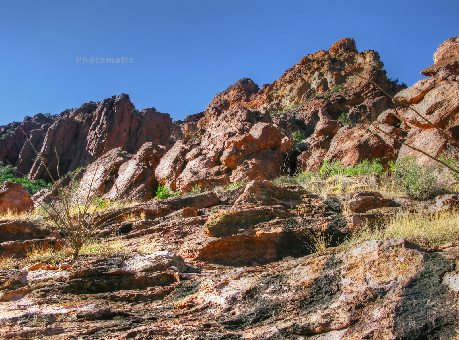
The terrain is pretty lush in parts.
Our first stop was at Bates Wells
The last time we were here the park services was working on the old ranch house. There was no one home today..guess it was too early.
One of the windmills on the old ranch
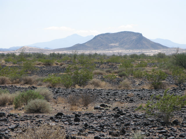
We continued on enjoying the mountain vistas. This area wasn't quit as lush as the beginning.
Look how straight and tall these Saguaro are!
The road gets really sandy in spots and the boarder patrol has put down these metal mats to help with the erosion.
What are these tires doing here?An ominous sign of bad road conditions? Actually, the tires are drug behind the boarder patrol trucks to smooth out the dirt road and also to help them determine how many vehicles have gone over the road. It is one way they have of determining if there has been unusually high vehicle or pedestrian activity that may have been smuggling or illegal aliens traveling by foot.
The road was recently "tire drugged" as there aren't too many fresh tire marks.
This sign is self explanatory. If you need help, and you don't have your US passport or proof that you are a US citizen, you may get a free ride back to Mexico!

In the beginning of this posting there was a picture of the lush desert. As we drove further we encountered some flowers and sandy desert. Aside for these flowers there was little vegetation.
And we drove over a lot of lava and lava beds.
Lava beds and then the sand dunes in the distance, with Mexico near the mountain.
The monument commemorating the establishment of the Cabeza Prieta.
As I was driving a long I saw something shiny. At first I thought garbage, i.e. cans and bottles. But when I investigated further I determined they were shiny rocks...what is called desert varnish.
I guess most folks drive the road the opposite direction then we did because this sign was at the end of our trip.
Since I was in the lead and driving most of the time, I didn't take as many pictures as I normally do. The road had a lot of variety from lush valleys of Saguaro and Cholla to sparse areas with forests of Ocatillo only. It made for a long day as we didn't exit at Wellton until 5:30 and still had to drive back to Organ Pipe via the highway..another 150 so miles. A great day, but a long one. I'd love to do this trip again, but in segments. There are several camping spots, so maybe next time.....


 Quitoboquito is a natural Oasis in the desert, and part of the Organ Pipe Cactus National Monument. OrPi also borders on Mexico's Reserve de la Biosfera El Pinacate with only Highway 2 separating the two parks. Although the road to Quitoboquito is closed, free van tours are offered by the park on the weekends in February. The area is perceived by the media as "potential threat" to visitors (thus the reason this part of the park is closed) and the van tours are escorted by park rangers and park rangers have a presence while touring the pond. The "perceived threat" is due to proximately to the Mexican boarder, which is only a few feet from the road in places.


