Organ Pipe National Park

Organ Pipe National Park

About Me

I purchased "Sadie''s House On Wheels "in late 2007 and loved traveling in a motor home so much that I went on the road full time in late 2008. I started writing this blog to help me remember all the wonder places I have been and it allows me to share those places with my family and friends. Summer of 2013 I decided to hang up the keys for a while and moved back into my stick house. After nearly two years, I am on the road again.

Wednesday, May 8, 2013

Heading North, May 4-5

I was on the road pretty early after doing all the RV stuff....dumping, filling, hitching up etc.  I definitely was not looking forward to the drive through Las Vegas.  The last few times I've been tangled up in road construction work.  With it being Saturday I was hoping the traffic would be light, which it was, but even better, most of the construction was done on I-515 which connects to I-95.  It was a long day, but I made it to Walker Lake, about 125 miles from Reno.


The drive from Walker Lake was short and easy, especially since it was Sunday morning...no traffic. So, I dropped Sandi off, ran some errands in town and then scooted up to Portola, California about 45 miles north where I am parked at Jeremy's house.  I've spent the past few days catching up on this blog and regrouping.  I am heading over to the California Coast tomorrow to visit with my mother and spend Mother's day with her and see my brother.  This will be my last chance to visit for a while before starting my Camp Host job at Wild Plum campground near Sierra City on May 17.

Its been raining since I arrived, a huge change from dry New Mexico and Arizona. In between showers , I did get out for a short walk behind Jeremy's house and all the mule ears are in bloom.

Thank you Sandi for joining me while I headed back.

Lake Meade National Recreation Area, May 2-3

I passed through Boulder City last fall when traveling with Joel on our way back from Tucson, so I was familar with the Boulder Campground and looking forward to crashing for a day or so before heading north to Reno.  The Wind Gods heard my plea from the other day  and the winds were much calmer and the drive easy.

I wanted to check out the visitor center and tour Hoover Dam and walk the new bridge bypass while here as well as explore some of the viewpoints of Lake Meade.  Hoover Dam is an engineering wonder and I still marvel at all of the man hours it took to built and the  resulting big lake..Lake Meade.  Of course with the forming of Lake Meade came a thirsty population in the form of Las Vegas


There are several tours offered at the dam and Sandi and I opted for the shorter one which takes you down inside .  The picture below is the concrete part of the dam holding Lake Meade back.  I was standing at the the base of it.
 Some of the turbines:
 The new Mike O Callagman-Pat Tillman Memorial Bridge.  It has been dedicated to Pat Tillman, pro football player who joined the marines and was killed in action.
 Looking towards the Arizona side
 It took six years to fill the lake to the high water mark.  Today the lake is 46 feet below average and 146 feet lower than the high water mark.  The low water level is due partly to thirteen years of drought and the increase in demand for water. Water is divided between California, Arizona, Nevada, and Colorado.
 Over view of the dam for the new bridge.
 Yep, I walked the whole length of the bridge
 The medallion indicating the Arizona and Nevada lines.
 Lake Meade has a huge Marina. The Boulder Campground is in the distance. Next time I'll bring the Kayak and schedule much more time.
We. drove Lake Meade Drive all the way up to The Valley of Fire State Park and through part of the state park.  I'm not sure why, but I didn't take any pictures although the drive was very scenic.  The state park is beautiful but a little pricey ($25 per night) for dry camping and most spots would barely work for my little RV. We turned round and drove back to the Boulder Campground which was filling up with weekenders from Las Vegas.

Tomorrow I head back to Reno to drop Sandi off.  I won't make it in one day but should be there by Sunday.  Sandi's husband is anxious to have her back.


The Grand Canyon, May 1

I've been to the Grand Canyon several times and the most recent visit was back in September of 1994.  I didn't enjoy it then due to the crowds, so I didn't have very high expectations of avoiding the crowds this time either. Sandi had never been to the Grand Canyon, and I tried to explain the "Disneyland" atmosphere to her, but was willing to make a day trip  in the Jeep since I was only about 1 1/2 hour drive from the Desert View entrance to Grand Canyon.


We got a very early start and arrived at the Desert View parking area by 9:00.  Much to my surprise there were hardly any cars there.  Thinking back, I don't think I had been to this part of the canyon before because I don't remember The Watch Tower, one of the main attractions to this part of the Grand  Canyon.

The art work on the ceiling is unique


 Looking up from the bottom floor.  There are three stories.
 One of the spectacular views from Desert View Point.


I drove over to the Desert View Campground to check it out.  I hadn't planned on camping because I figured the place would be a zoo and it is first come first serve. The literature I read said to be there early to get a spot.  The campground was empty.  Huh?? It turned out May 1, was the first day it had open for the season.

Next we drove over to the main visitor center about 25 miles down the road, not the visitor center I remember in the village, but the new visitor center with a parking lot that rivals the size of Disneyland.  Wow, was I in for a surprise! The shuttle systems that take you into the village and out to Hermits Rest are great!  Parked the Jeep and took the shuttles everywhere, walked part of the rim, and saw most of the highlights.  And..there were people but not the crowds I remembered.  So, since I didn't have very high expectations, they were exceeded greatly, and I now think a day visit is worth it.  No parking hassles along the rim trail. It was a really pleasant experience.

I'll just post a few pictures of the Canyon.


Sign of spring!
I walked around the village and visited El Tovar and it is all the same with lots of people. I stayed in Bright Angle Lodge last time and had dinner at the main restaurant in El Tovar then.  I'm not sure how far in advance you need to make reservations today, but back in 1994 we called several months ahead but nothing was available so we call  everyday for two weeks prior to our arrival hoping to get a cancellation.  We got one for several nights on the south rim, but were never able to get one for the north rim.

My bucket list still has a rim to rim hike with a night or two at the Phantom Ranch.  Need to get that done while I can still hike.

Next stop, Boulder City.


Sunset Crater Volcano NM and Wupatki NM, April 30

I headed towards Flagstaff under very windy conditions.  Please make it stop!  Fortunately, I didn't have more than a two hour drive to my destination just north of Flagstaff at the Sunset Crater Volcano, NM.  I had read there was a Forest Service Campground there as well as several other areas on BLM land that allowed overnight camping.  I checked out the BLM spots on the east side of Highway 89 just north of Flaggstaff and they weren't really suitable.  There were large drainage ditches that I would have to drive over to get to the sites  and I don't have enough clearance.  Next, the Bonito Forest Service Campground located in the Sunset crater Volcano NM.  Closed! Won't open for a few more days. So plan C, a gravel road just off the entrance to the park which was listed in my Days End.  It turned out to be a great place to crash for a night a two.

Once I got settled Sandi and I headed out towards the crater.  I didn't realize that you really can't see the crater, but you can see lava flows.


The Sunset Crater road continue on to Wupatki NM linking the two parks together.  There are several pueblo ruins along the road, but after seeing Canyon de Chelly and Chaco Culture, the ruins were sort of anti-climatic.  We did stop and see the main run of Wukoki Pueblo near the visitor center.

 The structure is a little different in that the masonry incorporates some of the rock formations of the area.
 A very large, simple Kiva is set away from the main house.
 Now why would I post a picture of a chimney.  Well, its not a chimney but a blow hole.  Apparently there is an underground tunnel of some sort  and depending on the barometric pressure, air blows up through the hole. On a hot day this is the place to be, because the air coming up through the hole is cold.
 The back side of the pueblo.

The scenic  drive connecting the two monuments is less that 40 miles and loops back out to Highway 89, so I made my way back to the RV in time to catch a few sunset  pictures.
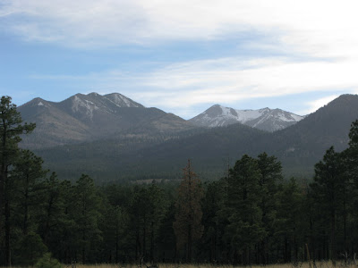
 And this is the view from my window.  It is so nice to see mountains and pine trees again even if its hazy from all the wind.

Tomorrow a quick trip (very quick) to the Grand Canyon.


Hubbell Trading Post, Painted Desert and Petrified National Park, April 29-30

I was able to return to the campground and dump, fill, and hook up and be on the road again by 12:00.  Check out time is 11:00, but no one said anything about me staying late.

I drove through Chinle and continued on Highway 191making a quick stop at the Hubbell Trading Post National Historic Site.  Some of the old building at the trading post are interesting, and the trading post itself is full of expensive trinkets, although there was some nice pottery and weavings.


The wind kicked up and when I hit I-40 it was really bad, fortunately I didn't have too far to drive before the entrance to the Painted Desert kiosk. Basically the Painted Desert and Petrified Forest have been lumped into one park with Historic  Route 66 thrown in.  So I entered at the Painted Desert (North on I-40) and exited at the Petrified Forest (south).  I'm not sure where one begins and the other ends, but the scenery is unique and worth the 30 mile or so drive south.


 This is the Inn along Historic  Route 66 which is now a museum


Route 66 takes off here and is commemorated with an old car.


I drove all the way to the end and parked just outside the park at one of the gift shops for the night. There are two gift shops at the intersection of the park road and Highway 180 and both allow dry camping over night for free and one even has electric hook ups for a small fee. They also offer free small pieces of petrified wood.   On Tuesday morning I backed tracked some and caught the Blue Mesa Trail and the Crystal Forest trail.

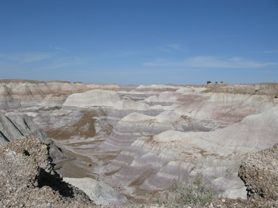
The Blue Mesa Trail has a distinct blueish purplish color, and my pictures don't do the colors justice.  There are petrified logs all along the paved trail.  The sign at the beginning  of the trail indicated a steep grade.  Well there is a grade, but the whole trail is paved and the grade is not that bad...well, maybe if you are in a wheel chair and someone is pushing you back up the hill.

 Views from near he beginning of the trail:


 The trail winds down among the knolls.


Note the petrified logs towards the bottom of the picture


The logs piled up in the ravine


You can see the paved trail in the middle of the picture.  The landscape is almost surreal.

A quick stop at Agate Bridge. The Petrified Log has been reinforced with concrete so not to break and fall.  The plaque nearby stated that today the Park Service philosophy would dictate Agate Bridge remain in its natural state.  In other words, left to deteriorate and fall into pieces.  What do you think? Should icons like this be left alone or preserved for future generations?

I continued to the Crystal Forest named so because some of the petrified wood was crystallized and glistens in the sun.  Huge chunks of petrified wood dotted the landscape


 This log looks like some lumber jack was cutting into to perfect rounds. The white center is crystal.
 Look how real the bark looks.


An unusual rock formation.

I stopped at the Petrified Forest Visitor center and walked the short loop exhibiting more petrified logs.  At this point I'm really getting a sensory overload. I headed back out on Highway 180 towards Holbrook and caught I-40 west again.  Very, very windy which made everything really hazy.  Next stop, somewhere around Flagstaff.