 Black Canyon of the Gunnison National Park
September 4-6
View of North and South Rim in the morning
This is a fairly new National Park. It had been a National Monument until 1999 when the Clinton Administration designated it a National Park. What makes this canyon unique is the type of rock that the Gunnison River cuts through. The canyon is made of much harder rock then say the Grand Canyon or Zion. The canyon is deep and narrow, thus the name Black Canyon because light does not always reach the bottom. One section of the canyon is 2772 feet deep. While the river has lots of white water and would seem a kayaker's dream, the national park river section is extremely hazardous and not navigable.
Treacherous white water in the park

Black Canyon near the deepest part of the park
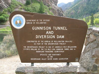
In the early 1900's a tunnel was dug to divert water to the nearby landowners so they could grow crops. This was quite and engineering accomplishment and the tunnel is still used today. We participated in a short tour and talk provided by Ranger Paul how the settlement was established while the tunnel was being dug.
Near the diversion tunnel
While staying at the Black Canyon we took a side trip towards Ridgeway on a dirt road near the Dallas Divide area. Our objective was to hike 8 plus miles with a 2000 plus elevation gain up to Lower Blue Lake and continued on to the Middle Blue Lake and Upper Blue Lake and perhaps reach the pass. The hike was a very challenging, mostly due to the high altitudes and steep rocky terrain. Our plans to reach the pass were squelched due to the high altitude (approximately 12,000ft) and rain. However, our efforts in reaching the lakes were worth it. The first lake was breath taking. The middle lake and upper lakes were also beautiful, but the terrain surrounding them was much more dramatic than the lakes themselves. The hike back down to the Jeep was fast and easy as we intermittently sought shelter in the trees from the rain.
Heading up the trail to Lower Blue Lake
Dramatic scenery on the way to Blue Lake
Falls along the way
Lower Blue Lake
Sadie dog, Queen of the mountains! (or should I Blue Lake)
Lower Blue lake on the way up to Middle Blue Lake
Middle Blue Lake
Trail on the way to Upper Blue Lake. Note the ominous clouds.
Upper Blue Lake
The Pass. Upper Blue Lake is to the left
Wild flowers still in bloom along the trail
So far South West Colorado has exceeded my expectations. The high Sierras are beautiful, but the southern mountains of Colorado rival them. I'll be heading further south to explore more and travel some of the back country Jeep roads. I'm told this is legendary Jeep country and my Jeep is pining for the rocks and dirt.


Beautiful photos - I especially like the morning shot. It's hard to get a good picture of that place. And definitely my kind of campground - NO GENERATORS! I'll be right over.
ReplyDelete