Big Bend National Park is HUGE!! It's very diverse from craggy mountains to desolate desert and the Rio Grande River borders the park and Mexico. There used to be border crossings into the park, but no longer which is a sad for the villagers across the river. There are several visitor centers and it is almost like the park is divided into three sections. Fortunately, we had the time to touch on each area a little bit, but the park is so vast, we hardly scratched the surface. We talked to several RVers who had returned time and again. When we arrived on Sunday, the Rio Grande Campground was pretty empty but by the time we left it was the middle of Spring Break and the campground was pretty full. The Rio Grande RV Campground has hookups but at $32 a night we opted for the Rio Grande Campground at $7.00 per night with the Golden Age pass.
Our first stop was at the visitor center at the North entrance to the park to get "the lay of the land". We also checked at the visitor center at our campground and purchased three paper back guides which proved invaluable. The three included scenic drives on paved and improved dirt roads; back roads; and hikes. So with the guides in hand we were able to hike and drive successfully during our stay:
Monday, March 7, Lost Mine Trail. This is a "classic" for the park near the Chisos basin. It is a 4.8 mile round trip with at least 1000 foot elevation gain. There is very little "level" trail on the way up but the payoffs were the spectacular views.
Looking off towards Mexico to the south
Pretty rugged country. One of the valleys in the Chisos Mountains.
Casa Grande from the Lost Mine Trail, part of Chisos basin .
Chisos Mountains
This little guy was vary curious and wanted some of our lunch. No such luck!
The trail went up and up and up...
Joel made it to the top and some folks took a picture to document the event to show he really did climb all the way up! Of course I had no trouble.
After our hike we went into the Chisos basin and explored the campground. There is also a nice lodge and visitor center. The basin area was a lot smaller than I expected. I thought for such a large park there would be more camping in the mountain area. I guess I had vision of Yosemite, but thank goodness it is nothing like Yosemite.
Tuesday, March 8. Boquilla Canyon. This is a short little hike along the Rio Grande River. One could cross the river into Mexico very easily, but there are severe fines if caught returning. U.S. citizens must cross at official border crossing. The canyon is a prime river trip and kayaks and canoes can easily put in a little ways up the river near the campground but the take out at the canyon means porting your boat about 1 mile back to a parking area or continuing three days down river. Also, permits are needed and I'll go into that later in another post.
Boquilla Canyon
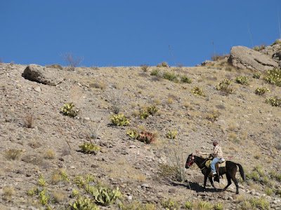
Vaquero crossing the river from the Mexican side to the U.S. What you don't see is a young man on the hill near the trail acting as look out to let him know if the border patrol is coming.
He is carrying walking sticks and trinkets for sale to the U.S. side, apparently not worried about the border patrol.
The Rio Grande looking towards Mexico
The Village of Boquilla is in the distance. The little border village prospered on tourist trade until the borders closed. Now, the villagers cross the river and leave walking sticks and and other trinkets along the paths with "donation" cans and jars and crudely written signs as price lists. There are also other signs soliciting donations for the school kids. I talked with one village resident and he said times were really hard and that more and more people were leaving the village to go elsewhere to make a living. There are signs posted by U.S. authorities warning that the purchase of these trinkets is illegal and if an U.S. is caught with the contraband it will be confiscated and fines could be levied and that "legal" trinkets could be purchased at the Chisos Lodge and other retail stores . The walking sticks were priced at $6.00, but at the lodge they were priced at $18.00. Hmm, I wonder who gets the other $12.00.
Wednesday, March 9. The Ross Maxwell Scenic Drive. The drive goes to the other side of the park with the Santa Elena Canyon being the highlight of the drive. We made several stops along the way and then took the Old Maverick Road (12 miles of dirt road) which intersects the main road back to the the Rio Grande campground.
Tull Canyon on the Ross Maxwell Scenic Drive. Note the shadows at the bottom of the picture. Guess who was having some fun.
It was very hot ( upper 90's) so we didn't walk the canyon floor.
We did walk up to the Burro Mesa pour off. The falls would be really spectacular in the rainy season, but it had been very dry. Spring is just around the corner, but everything is so very dry.
These pink cactus were everywhere. I'm not sure if they were turning pink because of the very dry climate or this is their natural state.
Soto at the Soto overlook. The heart of the Soto is used to make a liquor and the leaves are used for making baskets.
This was another vista along the drive. Its call Mule Ears. There is a nice hike to the base, but not this time.
Soto with Santa Elena Canyon off in the distance, our main destination today.
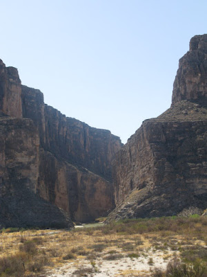
Santa Elena Canyon down river
The river is was hardly flowing when I took this picture in the afternoon.
You know who playing in the rocks.
The Rio Grande at the end of the canyon. There is a nice little hike that leads to an overlook.
We talked with one of the river guides about where to put in and take out our kayaks without doing an over night. He suggested paddling up river from the canyon a little ways and then turning around a floating/paddling down. Permits are needed, so we decided we would check into that another day.
We then back tracked slightly and took the Old Maverick dirt road back to the main park road to our campsite and along the way saw some interesting sites.
Luna's Jacal. A Jacal is a mud hut. This one housed a man named Luna and a large family. Luna lived to be close to 100 years old.
Imagine raising a family in these small quarters
This is what the ceiling is made off. Ouch.
Some nice scenery along the way, some which reminded me of the Bad Lands of the Dakotas.
These are ruins near one of the primitive campsites along the way called Turlinqua Abajo. At one time there were cottonwoods all along the river behind the ruins.
The total mileage was almost 131 miles. A long day, but the sites were well worth it.
Our first few days at the park have been pretty busy, and we have seen so much. I think I might need a day or two to digest everything.


No comments:
Post a Comment